|
Day: |
104 |
|
Date: |
Thursday, 14 August 1986. |
|
Start: |
|
|
Finish: |
|
|
Daily
AT Miles: |
16.8 |
|
Daily Other Miles |
0 |
|
Total
AT Miles: |
1993.0 |
|
Total All Miles |
2051.0 |
|
Weather: |
Mild, sunny. |
|
Accommodation: |
|
|
Nutrition: |
Breakfast: Muesli, health drink.
Lunch:
Biscuits and peanut butter, health bar.
Dinner: Macaroni cheese,
instant pudding. |
|
Aches: |
Lower right back chafing. |
|
Animals Seen: |
Squirrels. |
|
People Seen: |
14 overnight hikers, some others. |
|
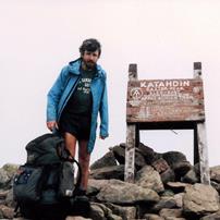
Pictures: |
Here |
|
GPS Track: |
|
|
Journal: |
Got up at 5:30am and, after water-proofing
various pack items with garbage bags for the coming Kennebec River
crossing, left at 7:10am. It was going to be a beautiful day as I
set out to try and reach the Kennebec, 17 miles away, by
lunchtime. The Trail passed through pretty deciduous forest for
most of the morning and also by three beautiful lakes. The second,
East Carry Pond, was particularly beautiful, with a loon calling,
and I took an early mid-morning break to enjoy the scene. It made
me feel quite melancholy that the trip was nearing the end. After a
break at Pierce Pond Lean-To, I pushed on to the Kennebec. The
Trail was new and, although following an attractive large stream,
was hard slow going. Just before reaching the Kennebec, I met an
elderly couple coming the other way who’d just crossed the river by
canoe. They said the river was running very high – too high to
ford. Alice Ference, an AT Thru-hiker nearing her goal, drowned
while fording the Kennebec last year, so I was a bit anxious about
the dangers involved. I reached the river, more than 100 metres
wide, at 2:45pm and found the two mid-river gravel bars, which were
supposed to be above water for safe fording, beneath the surface. I
was tempted to try the ford and assume I could swim pushing my
water-proofed pack if too deep, but decided to leave that as a last
resort for tomorrow morning. The river is supposed to be at its
lowest at 6am (there’s a dam upstream making timed releases of
water). It is possible to call in advance to arrange to be ferried
across the river, but I didn’t really want to do that, having walked
every step of the way so far. I had lunch and waited on the banks
in the sun for 1½ hours to see if there was any change in the water
level – there wasn’t – before walking inland 100 yards to a small
conifer grove where I set up camp. There is a major road across the
river. It is strange to contrast that normality with my
life-risking struggle to go on first thing tomorrow morning. Around
5pm, two hikers (I think) began testing the water depth on the other
side. The current was far too strong and the river too deep for
them to go more than a few yards from the shore and they gave up. I
had dinner early, made some preparations for tomorrow, and went to
bed at 7:30pm. |
|
ADVENTURE LIST
Round Ireland
(2016)
Hume & Hovell Walking Track
(2013)
Via Alpina
(2012)
Australian Alps Walking
Track
(2011)
Land's End to John O'Groats
(2010)
Round Oz Bike Record Attempt
(2009)
Round Oz Bike Record Attempt
(2008)
Round Oz Bike Record Attempt
(2007)
Australia Tip to Top MTB
(2006)
Adelaide to Darwin MTB
(2005)
Sydney to Melbourne MTB
(2004)
Three Peaks Race
(2004)
Appalachian Trail
(1986)
Alpine Track
(1983)
|