|
Day: |
089 |
|
Date: |
Wednesday, 30 July 1986 |
|
Start: |
|
|
Finish: |
|
|
Daily
AT Miles: |
23.6 |
|
Daily Other Miles |
0.9 (0.3 shelter, 0.6 restaurant). |
|
Total
AT Miles: |
1746.2 |
|
Total All Miles |
1797.4 |
|
Weather: |
Mild, overcast, fog and drizzle. |
|
Accommodation: |
|
|
Nutrition: |
Breakfast: Muesli, health drink.
Lunch:
Cake and ice-cream, cookies.
Dinner: Noodles and sauce, instant
pudding. |
|
Aches: |
None real bad. |
|
Animals Seen: |
3 snakes. |
|
People Seen: |
1 overnight hiker, some others. |
|
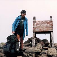
Pictures: |
Here |
|
GPS Track: |
|
|
Journal: |
Got up at 5:30am after a good night’s
sleep. It had stopped raining. I packed up and left at 7am, saying
goodbye to the others who I’ll probably meet again in the White
Mountains. Everything was extremely wet and rain was
forecast. Fortunately, the Trail was easy and not overgrown. A lot
of it was on roads and woods roads and I made good time – I suspect
the miles were short. I climbed to the top of Smarts Mountain
without a break. It was very steep near the top and the Trail was
extremely wet. It was alpine-like at the top and quite cool and
windy. Fog prevented any views. I descended down the difficult
rocky and wet Trail and then had some more road-walking before the
ascent of Mount Cube. Another wet difficult ascent but, at least
this time, I got occasional views through the blowing clouds – they
were spectacular. The descent was especially difficult and
dangerous in the wet conditions. I slipped and fell twice but
suffered no damage. I reached NH 25A at about 2pm and walked the ¼
mile to a small restaurant for lunch. Unfortunately, pancakes were
off at noon and they’d run out of apple pie, so I settled for two
plates of cake and ice-cream and six big fresh cookies. The
manageress was very nice. I left at 3:10pm to walk the remaining 7½
miles I’d planned. More very wet Trail and hence feet. Progress
was a bit slower but at least more level. It was through old
forest, reclaimed farmland and past weekenders. I stopped with
three miles to go to find there’d been a relocation. The distance
was supposed to be the same but, of course, the new Trail was slow
and I didn’t reach NH 25C till 6:40pm. I crossed it, and then a
stream, and found a good campsite on the other side amongst the
pines. I decided to try a fire despite everything being wet and was
successful. I set everything up as quickly as possible because of
the forecast rain but, fortunately, it held off and it was a
pleasant though hurried evening. I went to bed at 8:50pm. |
|
ADVENTURE LIST
Round Ireland
(2016)
Hume & Hovell Walking Track
(2013)
Via Alpina
(2012)
Australian Alps Walking
Track
(2011)
Land's End to John O'Groats
(2010)
Round Oz Bike Record Attempt
(2009)
Round Oz Bike Record Attempt
(2008)
Round Oz Bike Record Attempt
(2007)
Australia Tip to Top MTB
(2006)
Adelaide to Darwin MTB
(2005)
Sydney to Melbourne MTB
(2004)
Three Peaks Race
(2004)
Appalachian Trail
(1986)
Alpine Track
(1983)
|