|
Day: |
100 |
|
Date: |
Sunday, 10 August 1986 |
|
Start: |
|
|
Finish: |
|
|
Daily
AT Miles: |
22.3 |
|
Daily Other Miles |
0 |
|
Total
AT Miles: |
1928.5 |
|
Total All Miles |
1984.0 |
|
Weather: |
Warm, humid, mostly sunny. |
|
Accommodation: |
|
|
Nutrition: |
Breakfast: Muesli, health drink.
Lunch:
Biscuits and peanut butter, health bars.
Dinner: Noodles and
sauce, pop tarts. |
|
Aches: |
None bad. |
|
Animals Seen: |
Squirrels, grouse. |
|
People Seen: |
3 overnight hikers, 9 day hikers, some
others. |
|
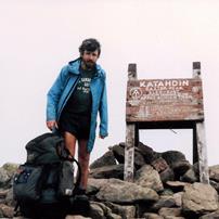
Pictures: |
Here |
|
GPS Track: |
|
|
Journal: |
We got up at 5:30am and left about 6:45am
with the daunting prospect of over 22 miles in front of us on the
boggy Maine trails. Fortunately, there were no major mountains on
our route for the day. We set off in foggy damp conditions and
first climbed to the fairly bare summit of Beamis Peak but couldn’t
really see anything. The Trail then descended over a series of
knobs until it reached Beamis Stream. It was too wide to rock-hop
across and we both ended up just ploughing through it. By this time
the weather was clearing and after our steep ascent to ME 17, we had
a great view over the lakes, forests and mountains to the west. We
only stopped for a short time to admire the view because we were
conscious of the distance we still had to go. The Trail levelled
out a little, though still gradually ascending, and was often boggy,
slowing us occasionally. John saw a moose, but I missed it! John
stepped up the pace in the better going parts, and I hung on. We
reached a lovely beach on the north-east end of Long Pond and we
both washed our socks and I went for a lovely swim during the 40
minutes we stayed there. We then left to walk another five miles to
the Little Swift River Pond campsite where we planned to have a late
lunch. The Trail continued to be boggy and, at one point, newly
clean from my swim, I slipped on a root and fell sideways into some
lovely black mud, dirtying my whole left side. We reached the Pond
around 3pm and spent 45 minutes eating and resting. We then moved
off through more deciduous forest and boggy trail with the intention
of breaking the remaining six miles into two three-mile
sections. However, we missed the rocky ledge supposedly marking the
halfway point, and walked all the way to ME 4 leaving us only 1½
miles to go. We were pleased that it looked like we were going to
reach the Shelter at Piazza Rock at around 7pm – an hour earlier
than last night. There were about five cars parked at the
trail-head and, as we climbed towards the Lean-To through the
forest, we heard a loud screech of tyres and then two big bangs of a
car crash. Probably some of the parked cars. We decided we
wouldn’t be able to do anything, so didn’t return to the scene. We
were very pleased to reach the Lean-To at 7pm and find no-one else
there (though there was a care-taker in a tent about 100 yards
away). We washed and had dinner, congratulating ourselves on having
an empty shelter, when a father and son hiking team turned up, very
tired, at 8:15pm. We chatted with them and the care-taker, who
brought us some cookies, before retiring around 9pm. |
|
ADVENTURE LIST
Round Ireland
(2016)
Hume & Hovell Walking Track
(2013)
Via Alpina
(2012)
Australian Alps Walking
Track
(2011)
Land's End to John O'Groats
(2010)
Round Oz Bike Record Attempt
(2009)
Round Oz Bike Record Attempt
(2008)
Round Oz Bike Record Attempt
(2007)
Australia Tip to Top MTB
(2006)
Adelaide to Darwin MTB
(2005)
Sydney to Melbourne MTB
(2004)
Three Peaks Race
(2004)
Appalachian Trail
(1986)
Alpine Track
(1983)
|